
Transparent scoring
Every hex score is broken down by factor. No black boxes, no hidden weights - just numbers you can trace.
Five groups
Every hex can be scored on factors from five groups of measures. You decide how much each factor counts - and you can see exactly how it adds up.
Learn more about scoringHow much is built in each hex, and what for - homes, offices, shops and other building uses.
Shops, cafés, restaurants, banks, schools and more - count competitors or find the gaps.
Who actually lives there, from public census data across Germany, United States, France, Spain, United Kingdom, Netherlands, Switzerland, Australia, Canada, and Brazil.
Income and housing figures, wherever a country's census publishes them.
Transit departures from public timetables, Transit stops, Street centrality and Pedestrian potential: how easily people reach each hex, and how much its timetable, streets and places invite walking.
Hex labels show weight × rank (0–100) within each 7-hex group—not raw measurements. The composite is their sum at each position.
Stacking factors
Score (Σ wᵢ × rank)
Rendered in the live map's Viridis ramp
The formula atlas
Seven named map types, plain words first and the field's term beside them: Score (a weighted sum), Amount (a count, rate or density), Variety (the Simpson and Shannon indices), Fair share (the location quotient), Missing (gap analysis), Clusters (Getis-Ord Gi* hot spots) and Cross two (a bivariate map). Change the map type and the formula, the legend and the colors change with it. Each card opens the same map in the app and links the guide that works it through on London.
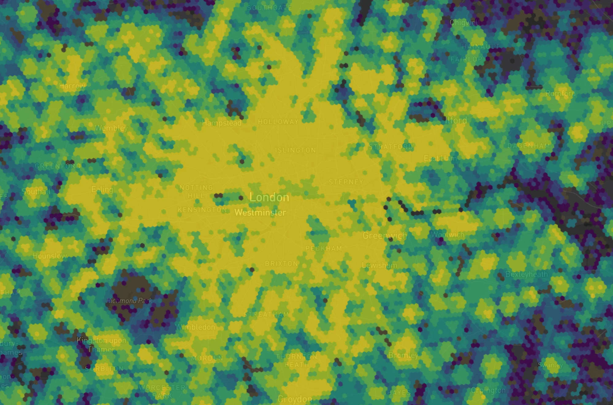
How much sequential · no special middle
Where is best overall?
London: Cafés, residents and transit stops, weighted into one score.
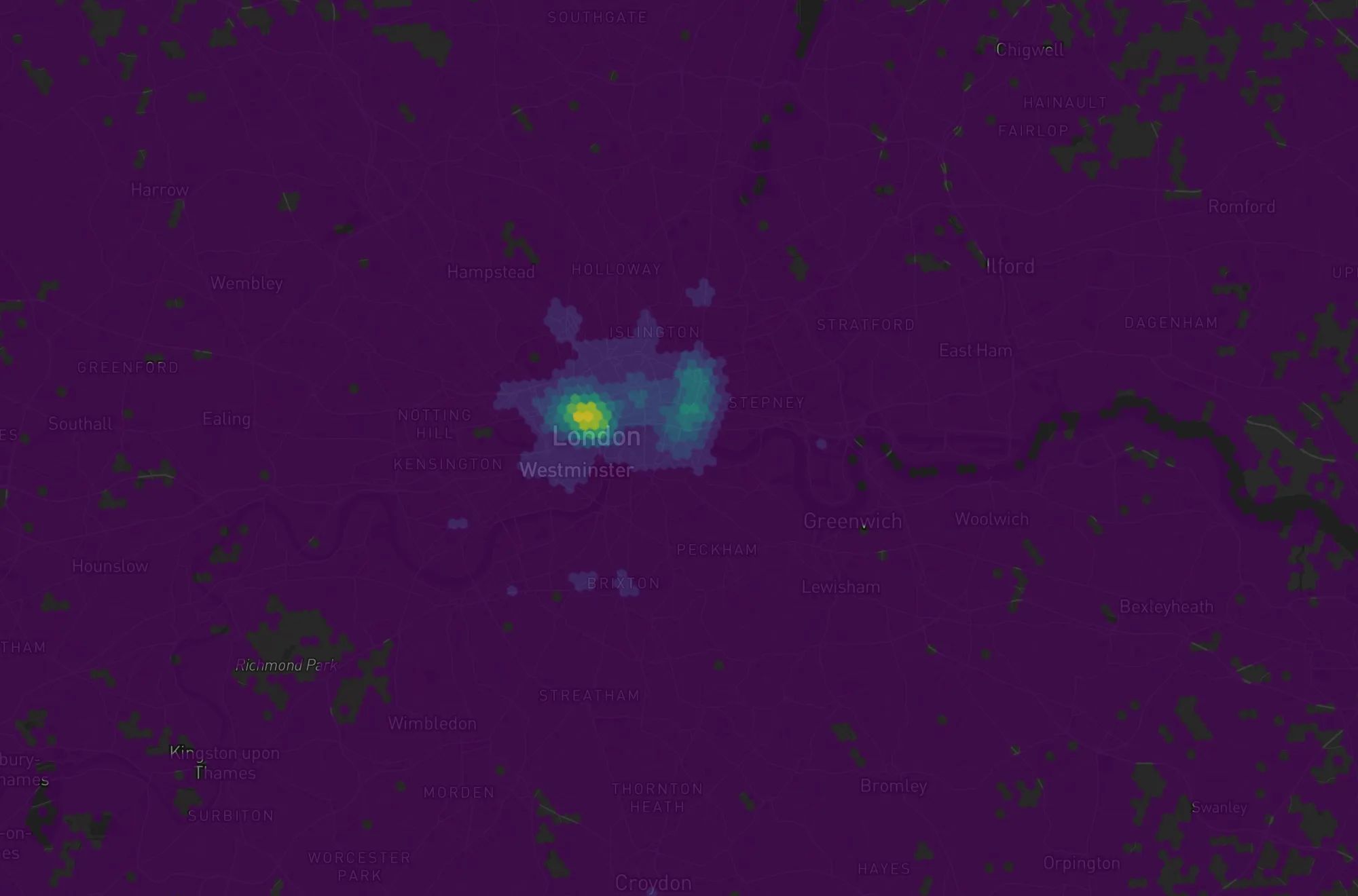
How much sequential · no special middle
How much is here?
London: Bars per km², within a 10-minute walk.
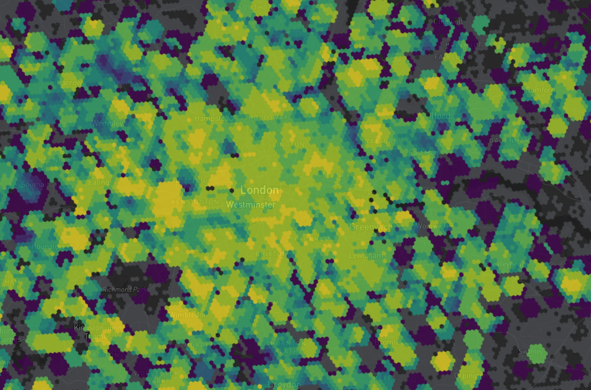
How much sequential · no special middle
How mixed is it?
London: Six cuisines within a 10-minute walk: how mixed.
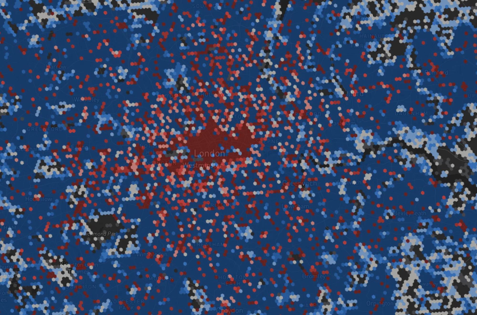
Compared with diverging · a middle that means “neither”
More than its fair share?
London: Cafés per 1 000 residents, compared to the London average.
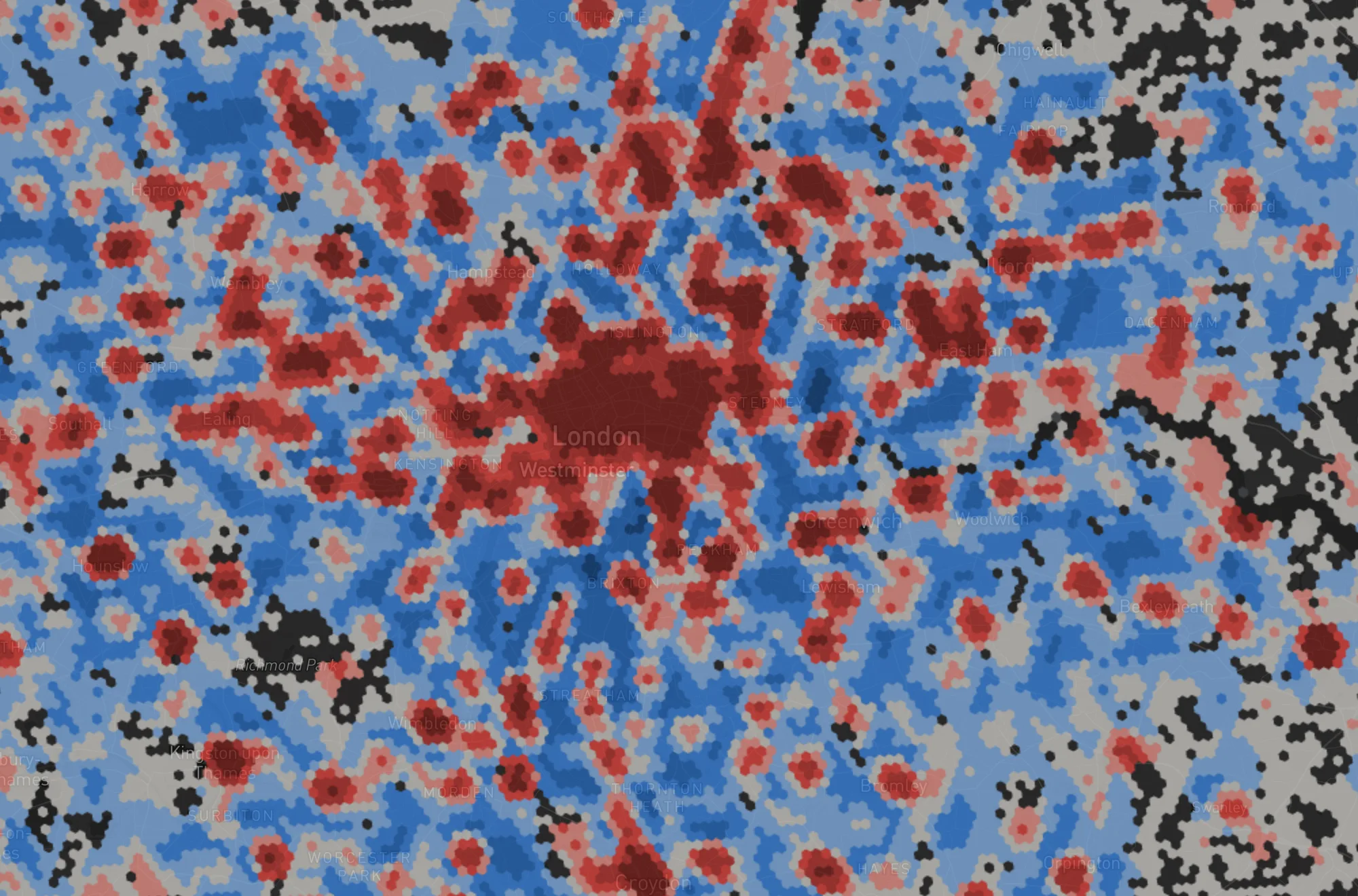
Compared with diverging · a middle that means “neither”
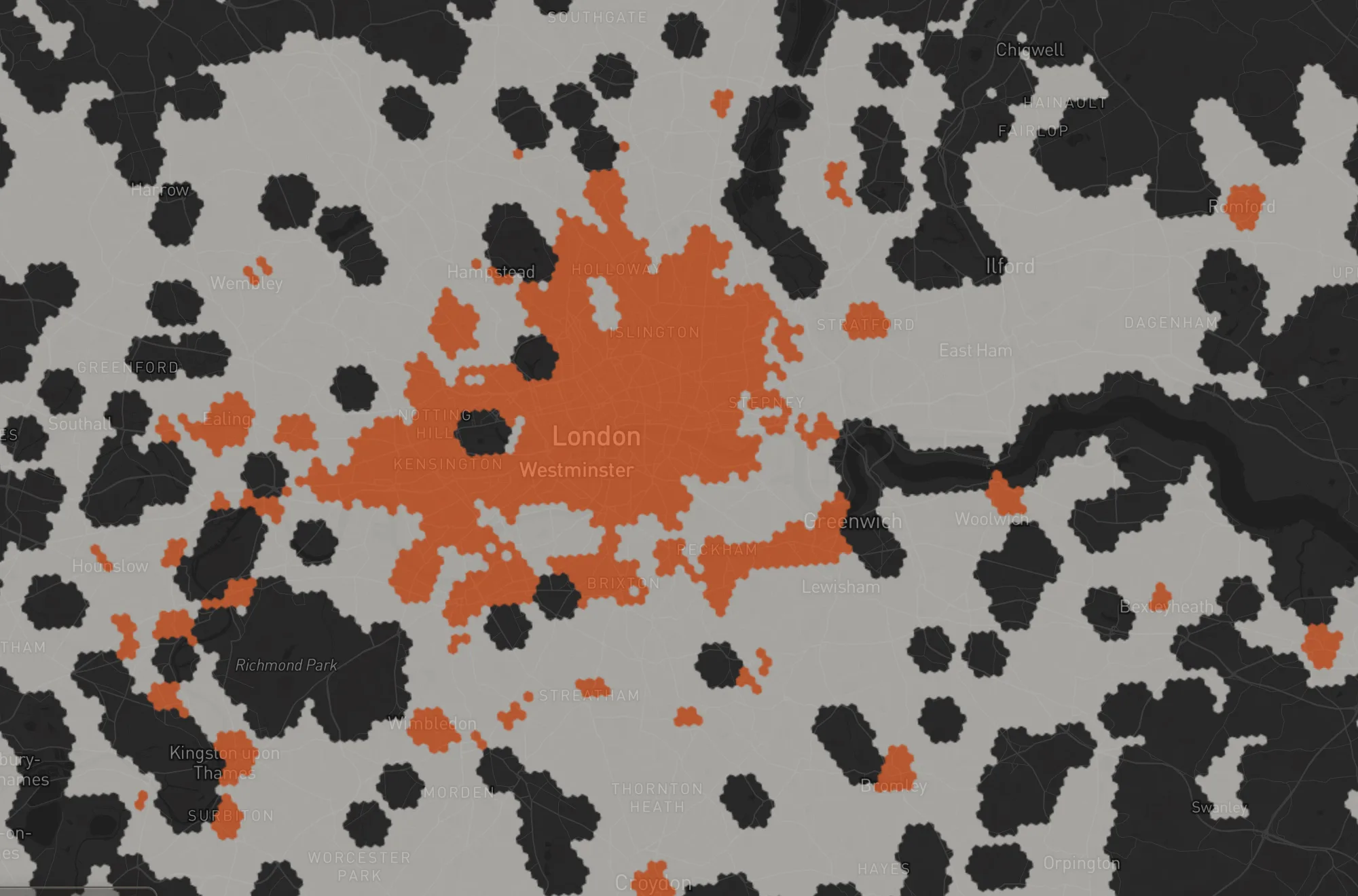
How many are missing?
London: Grocery stores missing for the people within a 10-minute walk.
Is it real classified · a verdict
Is this cluster real?
London: Pubs: the genuinely busy and genuinely quiet clusters.
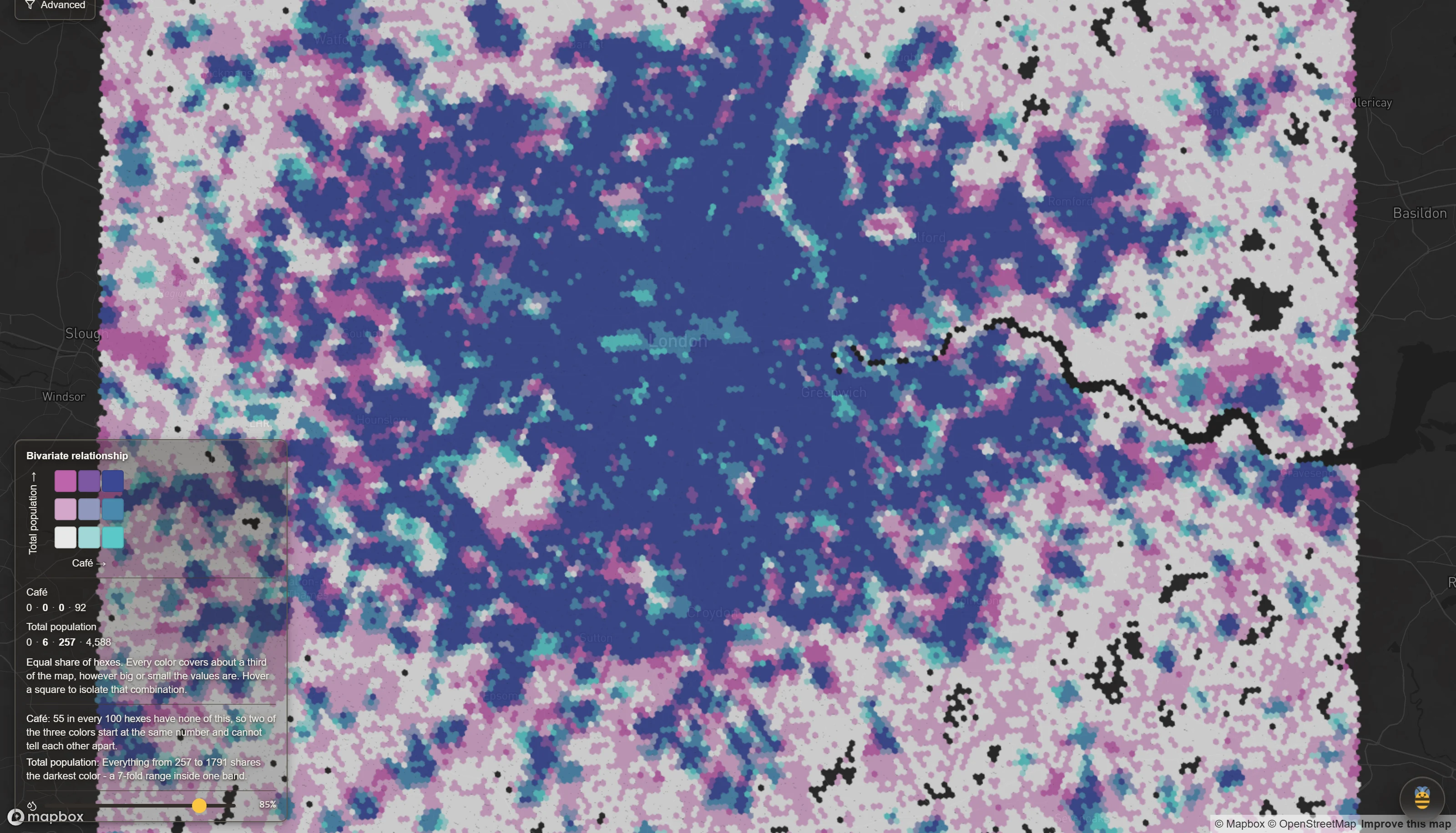
Two at once matrix · overlaid layers
Where do two things meet?
London: Cafés within a 10-minute walk, crossed with residents.
Inside the score, two more choices are yours: whether a hex must be decent at everything (the geometric mean, the way the UN Human Development Index works) or can make up for a weakness, and how each factor is placed before they combine - where it ranks, how far from typical, or lowest to highest.
Tools
Beside the formulas sit the tools, each walked through step by step on a real city: Territory mapping draws what a place can reach by travel time, Market share estimates how much demand each store wins with the Huff gravity model, and Divide splits a city into areas that hold the same amount (Split evenly) or gives every hex to its nearest starting hex by travel time (Closest).
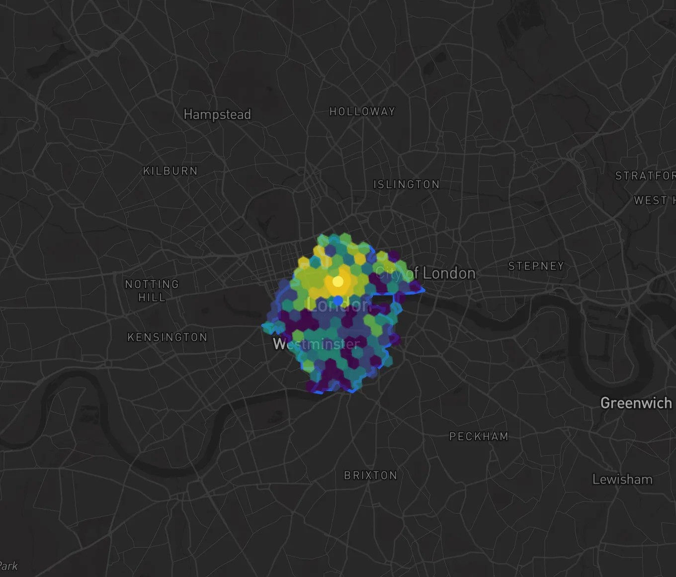
Territory
What can you reach from here in 10 minutes?
London: a 10-minute drive from Trafalgar Square, 133 hexes, with the map's colors inside it.

Market Share
How much of the local demand does each store win?
Berlin: four stores' catchments, each shared hex split by the demand each store captures.
Divide
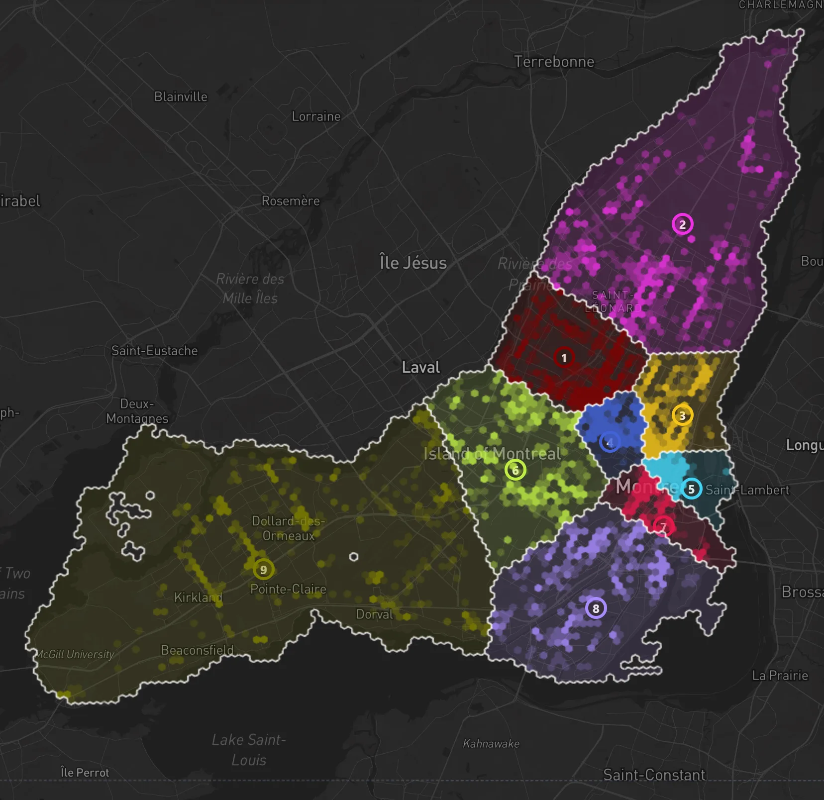
How do you divide a city into areas that hold the same amount?
Montreal: 9 areas, each holding about 897 of the city's 8,076 places to eat and drink.
Divide
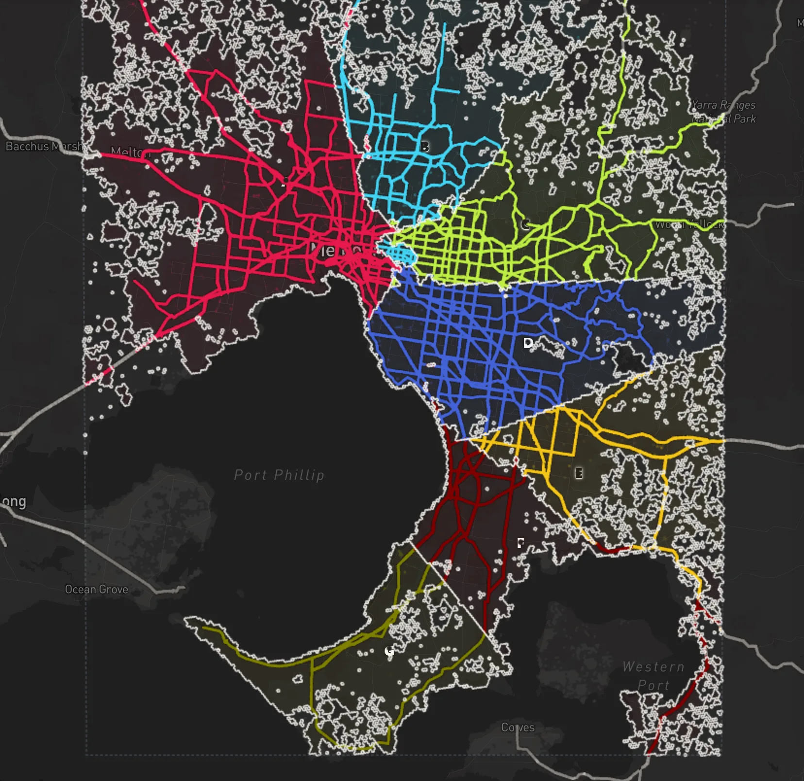
Which of your stores is nearest by drive time?
Melbourne: every hex given to the nearest of 7 starting hexes by a drive of up to 60 minutes.
Territory mapping & drive-time catchments
Turn any address or map click into a real territory - a drive-time, walk-time, cycling, transit, or distance catchment, or a polygon you draw yourself. Then compare reach, demographics, and places across every area.
Build a territory from any address or map click, then size it by driving, walking, cycling, or transit time - or a fixed distance radius. Draw freehand polygons when you need an exact boundary.
Add as many areas as you need - franchisees, sales reps, stores, or branches - and compare population, reach, and places across every territory at a glance.
Instantly see where two territories overlap and where coverage gaps remain, so you can balance territories fairly, prevent conflict, and avoid cannibalizing your own locations.
Every territory ships with a live breakdown - population and age, places, built volume, demographics, and accessibility - built from open data, with no spreadsheets.
Define territories from any address - driving, walking, cycling, transit, or distance. No sales call.


Market share & catchment analysis
Drop your stores and competitors on the map, draw a catchment for each, and MapBees estimates how local demand splits between you and the competition - using a Huff gravity model, explained for every store rather than hidden in a black box.
See the total demand inside your catchments and the exact share your network wins versus every competitor store.
Where catchments overlap, demand is contested. A Huff gravity model splits it by store attractiveness and travel distance, hex by hex.
Measure the demand your own stores pull from each other, so you can plan a network that grows coverage instead of overlapping it.
Rank every store, export to CSV, and see who lives in the contested area. Open data, transparent math.
Bring your own stores, or start from the competitors already on the map. No sales call.


Why MapBees
Most location tools hand you a number and ask you to believe it. MapBees shows its work, lets you steer, and keeps everything self-serve.
Every hex score is broken down by factor. No black boxes, no hidden weights - just numbers you can trace.
Adjust weights and directions and watch the map re-score live. Test a dozen scenarios in minutes.
Draw a bounding box or polygon to rank only within your target area, so the score fits your search.
Location Quotient, gap analysis, Getis-Ord Gi* hot spots, Simpson and Shannon diversity, Huff market share - each named in plain words with the field's term beside it, and a guide one click from the control.
Use cases
Whether you run a business, serve a city or are just choosing a home, the same transparent map turns a tough call into a decision you can stand behind.
Independent owners and first-time franchisees
Pick your business, score every hex in the city, then check fair share, gaps and real clusters before you sign a lease. Ten ready-made questions to start.
See the stepsMulti-store operators, franchisors and site selectors
Map each store's catchment and overlap, model market share and cannibalization, and compare markets the same way in 10 countries.
See the stepsPlanners, nonprofits, journalists and researchers
See where pharmacies, grocery stores, parks and banks are missing for the people who live there, who those people are, and the source behind every number.
See the stepsRenters, movers and relocating families
Shortlist neighborhoods on walkable streets, transit, everyday places and rent, then check what's within a short walk of a flat before you book a viewing.
See the stepsOrganizers, market traders and bar-crawl hosts
Find where bars and restaurants are densest, test that the cluster is real, check transit nearby, and see who lives within a short walk of your address.
See the stepsLocal marketers, agencies and campaigners
Find where your audience lives by age, household or income, where they're far above the city average, and who lives inside the area you plan to cover.
See the stepsFAQ
Location quotient, hot spots, gap analysis, bivariate and diversity maps.
Yes. Pick the Fair share map and any factor is shown compared to the city average - how many times the average each hex (one hexagon on the map, about 350 m across) has, where 1x is exactly its fair share. The field's term for it is the Location Quotient.
Yes, with a real significance test. The Clusters map (Getis-Ord Gi*) marks only the hexes where there is genuinely more or less of something around than chance would explain; everything else stays gray.
Yes. The Missing map shows how many more of something there would be at the city rate - a gap analysis. Blue hexes are short; red hexes already have more than expected.
Yes. The Cross two map shades each hex by where it falls on two measures at once, on a 3x3 grid - a bivariate map.
Yes. The Variety map scores a set of kinds - six cuisines, say - from 0 for a single kind to 1 for an even mix, as either 'How mixed' (the Simpson index) or 'How even' (the Shannon index).
It combines the factors with a geometric mean instead of a weighted sum, so a hex is only as good as its weakest factor: one factor at zero scores zero, however strong the rest are.
No. Every formula runs in the browser on the Free Tier - no install, no GIS license, and no formula syntax to learn. Each one is a named map with plain-word controls, and a guide that works it through on London is one click away.
Territory mapping, market-share analysis and dividing a city.
It is a territory mapping tool for drawing and comparing areas on a map. Pick any address or click the map, then build a territory as a driving, walking, cycling, transit or distance catchment (an isochrone), or draw a polygon by hand. Use it to map sales territories, franchise areas, delivery areas, and store catchments, then compare population, reach, and places across every area.
Drop a pin on the map, choose a travel mode (driving, walking, cycling, or transit) and a time or distance limit, and MapBees instantly draws the catchment as an H3 hex area. Repeat for each store, rep, or franchisee to build a full set of territories you can rename, recolor, and edit.
Yes. Add as many territories as you need and MapBees compares their size, population, and places side by side. Where two or more territories cover the same ground, the shared hexes are highlighted as an overlap area you can tap to inspect - ideal for balancing franchise territories fairly and avoiding conflict or cannibalization.
Every territory comes with an instant dashboard built from open data: approximate area and hex count, total population and age structure, places, built volume, demographics, and accessibility. Click the overlap area to see the same breakdown for just the contested overlap.
It is a market-share tool: you place your own stores and competitor stores on the map, draw a catchment (by driving time, transit time or distance) for each, and MapBees estimates how much of the local demand your network captures versus the competition - reported as captured demand, market share, contested demand, and cannibalization per store.
It uses the Huff gravity model. Inside the area where catchments overlap, each unit of demand is split between the competing stores in proportion to their attractiveness and inversely to travel distance or drive time, so closer and stronger stores capture more. Sole-coverage area outside any overlap is captured outright.
A catchment is the area a store can realistically serve, drawn by driving time, transit time or distance. Where two or more catchments cover the same hexes, that demand is contested and shared between the stores. Demand that only one catchment reaches is exclusive and captured fully by that store.
Yes. When your own stores sit close together, their catchments overlap and split the same customers. MapBees reports the cannibalized demand your network loses to its own overlap, so you can space new stores to add coverage rather than compete with yourself.
No. It is decision support for site selection and network planning, not an exact sales forecast. The Huff model shows the relative pull of stores given attractiveness, distance, and demand - ideal for comparing options and shortlisting new stores, then confirming with local knowledge.
Yes. Split evenly, in the Divide tool, divides a city, one of your areas or your own areas into 2 to 24 joined-up areas that each hold about the same amount of what you pick - residents, places, building volume or your own data. In Montreal, 8,076 places to eat and drink split into 9 areas of about 897 each.
Yes. Closest, in the Divide tool, gives every hex to the starting hex you can reach soonest - by driving, walking, cycling or transit, up to 60 minutes away - and colors the roads to match, so you can see which store, depot or clinic serves which part of the city.
Product, data, coverage, and everyday-use questions.
Yes. MapBees is free to use with no trial clock and no paywall. Every neighborhood score and map layer on the site is available at no cost.
No. MapBees is fully self-serve, so you can open the map and start analyzing locations instantly without a signup, login, or sales call.
Anyone making a location decision: small business owners, renters, event planners, marketers, and researchers. Business and everyday use cases are examples, not restrictions.
It splits the city into hexes - one hex is one hexagon on the map, about 350 m across (roughly 0.1 km²) - and blends the factors you choose for every one - measures drawn from five groups: Building volume, Places, Population & age, Affluence, and Accessibility. Each hex then shows a transparent per-factor breakdown so nothing is a black box.
Yes. You can tune the weight and direction of each factor in real time and watch the map update live, so the score reflects your own decision criteria rather than a fixed formula.
Enterprise site-selection suites are powerful but gated behind demos, licenses, and multi-thousand-dollar contracts. MapBees gives independent users transparent neighborhood scoring on a Free Tier.
Compare candidate neighborhoods on demand, competitor saturation, and accessibility before signing a lease, then weight the factors that matter most to your concept to shortlist the top hexes.
It highlights hexes with strong surrounding demand but relatively low saturation of your business category - the gaps where a new location is most likely to be underserved by competitors.
Yes. Renters and movers use it to screen neighborhoods for walkability, how often transit runs nearby, nearby shops, cafés and parks, and local demographics before committing to a lease or a move.
Yes. Event planners find neighborhoods with the right density of bars and restaurants and see where Pedestrian potential says the streets invite walking, while marketers match neighborhood demographics to a target audience to decide where to advertise or hand out flyers.
Open, public data only: buildings, places and streets from Overture Maps, boundaries from OpenStreetMap, transit timetables (GTFS) published by each city's transit agencies, and national censuses - Zensus 2022 (Germany), US Census 2020 (NHGIS) (United States), INSEE Filosofi 2021 and INSEE RP 2021 (IRIS) (France), INE Censo 2021 (Spain), ONS Census 2021 (United Kingdom), CBS grid statistics 2024 (Netherlands), BFS STATPOP 2024 (Switzerland), ABS Census 2021 (Australia), Statistics Canada Census 2021 (Canada), and IBGE Censo 2022 (Brazil) - processed into H3 hexes about 350 m across.
No. MapBees counts no people walking past. Where a city has it, Pedestrian potential stands in for foot traffic: an estimate, 0–100 within the city, of how much a hex's transit timetable, streets and everyday places invite walking. It is not a count of people.
Where a city's transit agencies publish their timetables (GTFS, the open format transit schedules are published in), Transit departures counts the departures scheduled per hour from the stops in each hex or within a 10-minute walk of it, on a typical weekday at rush hour (7–10 and 16–19) or at night (22–2). Where a city has no timetable yet, Transit stops counts the stops instead. Both describe the timetable and the map, not how many people travel.
Coverage spans major cities across Germany, United States, France, Spain, United Kingdom, Netherlands, Switzerland, Australia, Canada, and Brazil: Germany (Berlin, Bielefeld, Bochum, and 19 more); United States (New York City, Washington, D.C., Albuquerque, and 32 more); France (Paris, Bordeaux, Lille, and 7 more); Spain (Madrid, Alicante (Alacant), Barcelona, and 7 more); United Kingdom (London, Birmingham, Bradford, and 10 more); Netherlands (Amsterdam, Almere, Breda, and 6 more); Switzerland (Bern, Zürich, Basel, and 6 more); Australia (Sydney, Adelaide, Brisbane, and 9 more); Canada (Toronto, Brampton, Calgary, and 14 more); Brazil (Sao Paulo, Rio de Janeiro, Belo Horizonte, and 7 more). The catalog keeps expanding as new cities are processed.
Yes. You can draw a bounding box or polygon, or pick an administrative boundary, so scoring and ranking only consider the area you care about.
MapBees is a transparent, fast first-pass built on public data, so it is best for directional comparison and shortlisting. Confirm a final decision with on-the-ground visits and any required legal or financial checks.
There is nothing to hand over: MapBees needs no account or personal details, and analysis runs on public geospatial datasets rather than your information. If you add a file of your own points or areas, it stays in your browser: only what a map request needs travels with it, and the server keeps nothing.
No. The homepage shows a locked Berlin preview; the complete scoring app with every measure and map type, area drawing, and all available cities lives at /app.
Free Tier
Open the full interactive map and start analyzing neighborhoods in seconds. No sales call.
Launch the full map